
Properties in Gurugram





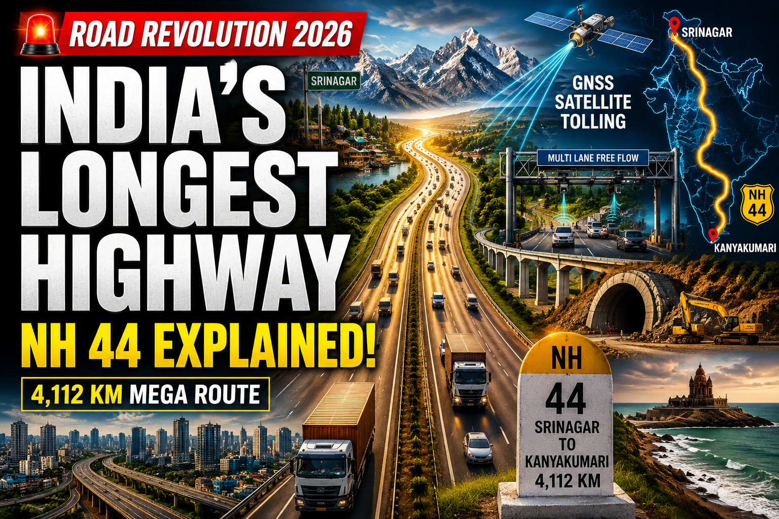
India boasts the second largest road network globally, with one highway in particular stretching throughout the entirety of this country. NH 44 passes through eleven Indian states, connecting major cities along its way from Srinagar to Kanyakumari, traversing thousands of kilometers through a range of varied landscapes.
There is more to the story than just a remarkable distance here, however. Recent changes have been made to highway numbering systems, while toll systems and infrastructure development for freight transport have been revolutionized as well. Here’s everything you should know about the subject.
What Is NH 44 and Where Does It Go?
NH 44 is the longest highway in India. It begins in Srinagar, Jammu and Kashmir in the North and ends at Kanyakumari, Tamil Nadu in the South, crossing Punjab, Haryana, Delhi, Uttar Pradesh, Madhya Pradesh, Maharashtra, Telangana, Andhra Pradesh, and Karnataka in between.
Some major cities that lie on NH 44 are Jalandhar, Ambala, Delhi, Agra, Gwalior, Nagpur, Hyderabad, Bangalore, and Salem. It is one of the most important highways for transporting goods from North to South of the country.

Why Do Two Different Lengths Appear?
Type in NH 44, and you get two figures: 3,745 km and 4,112-4,113 km. They are not both incorrect; rather, they are two approaches to measuring the very same highway.
The shorter measure refers to the corridor approach, taking into consideration modern day deviations where the road has undergone changes due to straightening and realignment processes. The longer measurement takes into consideration all of the bypass roads necessary to ensure that the highway maintains metropolitan accessibility and all branch routes integrated within the historical route coverage that has been consolidated to form NH 44.
It must be noted that there is no formal dual-standard that has officially been put into practice, but rather that at different points in time various agencies have employed differing methodologies to measure the length of the road, and no final reconciliation has ever occurred in publicly available records.

The Top 10 Longest National Highways in India.
Rank | Highway | Key Route | Length (km) |
|---|---|---|---|
1 | NH 44 | Srinagar → Kanyakumari | 3,745–4,112 |
2 | NH 27 | Porbandar → Silchar | 3,507 |
3 | NH 48 | New Delhi → Chennai | 2,807 |
4 | NH 52 | Sangrur → Ankola | 2,317 |
5 | NH 30 | Sitarganj → Ibrahimpatnam | 2,040 |
6 | NH 6 | Jorabat → Selling | 1,873 |
7 | NH 53 | Hajira → Paradip Port | 1,781 |
8 | NH 16 | East Coast WB → Chennai | 1,711 |
9 | NH 66 | Panvel → Kanyakumari | 1,622 |
10 | NH 19 | New Delhi → Kolkata | 1,435 |
A few highlights worth noting:
- NH 27 serves as India’s east-west spine, linking Gujarat’s export ports to the northeastern states.
- NH 48 is arguably the most commercially dense corridor in the country, connecting Delhi, Mumbai, Pune, Bengaluru, and Chennai.
- NH 19, shortest on this list, traces part of the ancient Grand Trunk Road—one of South Asia’s oldest trade routes.
How the 2010 Renumbering Created NH 44
Prior to 2010, there was no geographical arrangement in Indian highway numbering. The highways were numbered according to the sequence in which they were constructed. NH 7 used to be known as the longest highway that connected Varanasi to Kanyakumari. NH 8 was a highway connecting Delhi to Mumbai.
The 2010 rationalization introduced a grid-based system:
- Even numbers for north-south highways, increasing from east to west
- Odd numbers for east-west highways, increasing from north to south
- Three-digit numbers for branch routes (NH 144, NH 244, and NH 344 all branch off NH 44)
- Alphabetic suffixes for further subdivisions (NH 144A, and so on)
NH 44 did not emerge in a completely new format. It is an amalgamation of seven independent highways that used to exist: NH 1A, NH 1, NH 2, NH 3, NH 75, NH 26, and old NH 7. This is an administrative change, but the outcome has become operational as well: maintenance came under one roof (the National Highways Authority of India, NHAI), the paperwork process became easier, and there is only one planning authority now.
What Is Actually Changing in Tolling: 2025–2026
FASTag Is Still Here
Since its introduction in 2015 and implementation in February 2021, FASTag has employed RFID technology to automatically deduct a fixed fee when a vehicle enters a plaza. By early 2024, about 98% of all toll payments on around 1,200 toll plazas had been done electronically using the FASTag system.
GNSS Tolling: Promising but Not Yet Nationwide
There is an ongoing trial on a tolling system which uses satellites from the Global Navigation Satellite System (GNSS). This involves completely getting rid of all the existing toll collection stations and replacing them with overhead gantries where ANPR cameras take pictures of the moving vehicle while the satellite telemetry captures the distance covered.
But there are also indications from NHAI that the implementation of GNSS on a pan India basis is still far away. While two corridors – the Bengaluru-Mysuru highway and the Panipat-Hisar highway of Haryana – were chosen for studying the feasibility of implementing the technology, some difficulties seem likely. The main problem appears to be that the majority of vehicles don’t have the necessary On-Board Units (OBUs) that will enable their functioning, besides which issues related to continuous location monitoring are still pending due to privacy reasons.
On the other hand, ANPR-based barrier-free tolling seems to be getting closer, since the technology involves capturing the number plate images through high-quality cameras and charging the tolls via FASTags.
The government has further been amending the National Highways Fee Rules to improve enforcement and digital compliance, the latest one being in April 2026.
Bottom line: FASTag remains the operating standard. Barrier-free, camera-based systems are the near-term upgrade path. Full satellite-based distance billing is still a few years away.
Bharatmala Phase 1: Where Things Stand
Bharatmala Pariyojana is India’s flagship road infrastructure program, launched in 2017 with a goal of developing 34,800 km of highways across 31 states and union territories. Phase 1 focuses on 26,425 km of awarded corridors—economic routes, interstate connectors, and feeder roads designed to carry the bulk of the country’s freight traffic.
The original completion target was 2022. That has since been revised to FY2027-28.
According to the latest available statistics, more than 22,000+ km have already been constructed out of the total distance awarded, while the remaining construction is still being carried out. Delay has mostly been caused by cost hikes and difficulties in securing land, which is not uncommon for such large-scale projects.
In the next phase called Vision 2047, the focus is on changing the structure and moving away from public funding in EPC projects towards BOT models where road performance will motivate operators.
The Zoji La Tunnel: Engineering at Altitude
Beyond the plains, one of the most remarkable civil engineering initiatives in India is soon to be completed. This is the Zoji La Tunnel along National Highway No. 1, which is a 13.15 km long single tube, two-way tunnel constructed at an elevation of 11,578 feet above mean sea level. Once operational (expected by 2026), it will be the longest single tube two-way road tunnel in the world at such an altitude.
As it stands, travel across the Zoji La Pass takes about 1.5 hours along treacherous mountain paths that remain closed to traffic throughout much of the year due to heavy snowfall. The tunnel would bring that time down to 15 minutes and ensure a year-round connection between Kashmir and Ladakh.
Practical Takeaways
- NH 44 is definitively India’s longest national highway, running Srinagar to Kanyakumari through eleven states.
- The 3,745 km vs. 4,112 km gap reflects different measurement approaches, not an error—but neither figure has been uniformly standardized across all official sources.
- The 2010 renumbering replaced a chaotic legacy system with a logical geographic grid; NH 44 emerged from merging seven older highways.
- FASTag is still the standard toll system. Barrier-free, camera-assisted tolling is the near-term upgrade. Full GNSS-based distance billing remains years away.
- Bharatmala Phase 1 is on track for FY2027-28 completion, with well over half the awarded kilometers already built.
- The Zoji La Tunnel, due in 2026, will be a landmark achievement in high-altitude engineering.
Frequently Asked Questions
Q1: Which is the longest national highway in India, and what are its endpoints?
NH 44 is the longest, running from Srinagar in Jammu & Kashmir to Kanyakumari in Tamil Nadu. It passes through eleven states and connects cities including Jalandhar, Delhi, Agra, Nagpur, Hyderabad, and Bengaluru.
Q2: Why are two different lengths given for NH 44?
The two figures—around 3,745 km and 4,112 km—reflect different measurement approaches. One counts the direct corridor after modern realignments; the other includes bypass loops, branch integrations, and the historical extent of the older highways that were merged to form NH 44. Neither is a definitive error, but the gap has not been officially standardized in a single authoritative source.
Q3: What is GNSS tolling, and when will it replace FASTag?
GNSS tolling uses satellite tracking to charge drivers based on exact distance traveled, eliminating physical toll plazas entirely. Pilot studies have been conducted on select highways, but NHAI officials have stated that widespread implementation is still some years away due to the need for on-board units in all vehicles and unresolved privacy concerns. FASTag continues to be the primary system, with ANPR-based barrier-free tolling advancing as the more immediate upgrade.
Q4: What is Bharatmala Pariyojana and what is its current status?
Bharatmala is India’s flagship highway development program targeting 34,800 km of roads across 31 states. Phase 1 covers 26,425 km of awarded corridors and has been revised to complete by FY2027-28, delayed from its original 2022 target. More than 22,000 km have already been built. The next phase, Vision 2047, will shift toward private Build-Operate-Transfer funding models.
Q5: How does India’s highway numbering system work?
Since the 2010 rationalization, even-numbered highways run north-south (increasing from east to west), and odd-numbered highways run east-west (increasing from north to south). Three-digit numbers indicate branch routes off a parent highway, and alphabetic suffixes mark further subdivisions. This replaced the old system, which simply numbered roads in the order they were built.


Join The Discussion